


This past week South Florida has been pounded by rain. According to the South Florida Management district Broward has received 242% more rain than it normally averages for April. This was the reading and it was only April 13th!
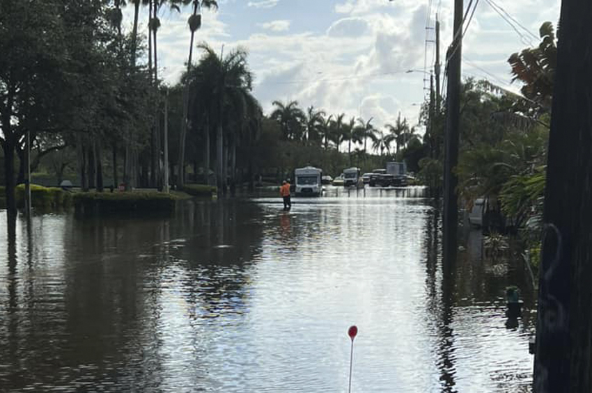
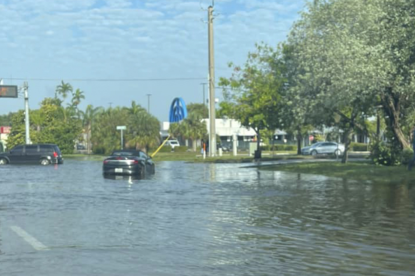
This above average rainfall left Oakland Park residents underwater and dealing with a recurring problem when there is too much rainfall, flooded streets. For some residents the flooding was not limited to the streets. For lower lying homes crept up their yards and in some cases breached their homes.
Flooding in Oakland Park has been a recurrent issue. The City has invested in upgrading its infrastructure. However, this rainfall was above and beyond what any City’s infrastructure could handle causing flooding throughout all of Broward County.
Residents Feel The Impact Of The Rains
In the Living in Oakland Park Facebook Group, the rain and its effects were a major topic of discussion. They shared information about which roadways to avoid, how they were dealing with the rain, and some about how the rain had affected their homes.
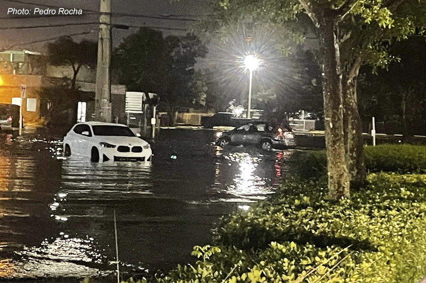
Local news showed footage of a completely flooded Broward Boulevard near the Andrews intersection. The boulevard was littered with cars. Some cars were completely submerged. The runway at Fort Lauderdale/Hollywood International Airport was flooded. Flights were cancelled leaving many stranded. Neighborhoods all over the County reported flooding. Many had to leave their homes for shelter. It was a truly a storm like no other.
At the end of it all Broward received an overwhelming 26 inches of rain. This volume of rain was unprecedented. One reporter called it a storm that only happens once every five hundred years.
Residents Helping Residents Avoid Flooded Areas
Matt Henry, one of the member of the Facebook group, suggested using Waze. Waze is a navigation app popular for helping users find different ways to get to a destination depending on current conditions. “The Waze app is great. It will normally just take you around things, but you can also just look at it and know where to avoid. FDOT crew is normally pretty good about updating it”, Henry shared.
In addition to Henry’s tip, other who know the group is popular for helping others, offered advice regarding which parts of the City were impassable. The most affected areas were :
- Oakland Park Blvd and 27th;
- 38th Street at Royal Palm Park;
- NW 39th St between NW 21 Ave and NW 31 Ave;
- Entrance to Lake Emerald condo;
- West of the train tracks to Dunkin/USPS intersection.
The City Works Toward Building Resiliency
The City is aware of the impact that heavy rains and flooding can have on residences and businesses in Oakland Park. As a result the City of Oakland Park has been working toward becoming more resilient to climate change and sea level rise. To that end, the City along with Wilton Manors joined the Southeast Florida Regional Climate Change Compact. This alliance was forged to build a climate resilient City in partnership with other communities.
In addition, the City adopted a regional Climate Action Plan and has invested over $60 million dollars in the underground infrastructure. Despite these investments, there is only so much water the ground can absorb. One way to understand this phenomenon is to think of the ground like a sponge.
When a sponge fills with water and it can no longer hold water, it will soak the area around it. This is essentially the same thing that happens here in Oakland Park. When the ground has absorbed as much as it can, any excess water wets the area around the saturated ground. When the water is an above average amount, like this past week, then the threat to property is real. In this case residents can prevent damage to their property by being prepared.
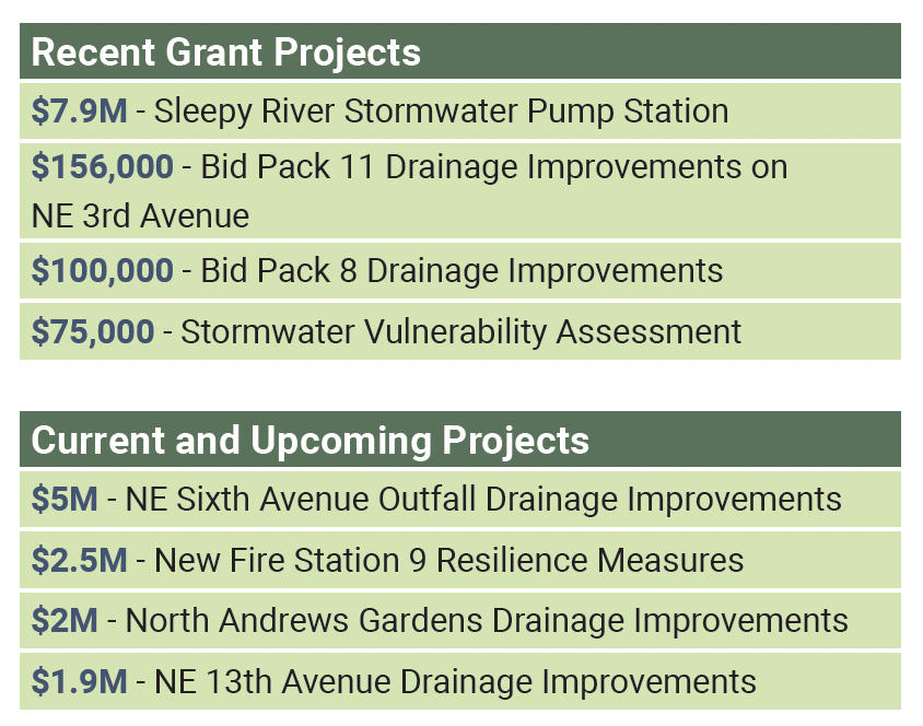
Recent Infrastructure Investments
How Residents Can Protect Their Property
- Make sure nearby storm drains are not blocked
- Clean gutters and direct drainage downspouts to permeable areas
- Get your roof inspected to check for leaks
- Add soil to your yard to grade your property away from your home
- Keep electrical outlets raised above your property’s base flood elevation
- Install storm shutters, impact windows and doors, and a reinforced garage door
- Purchase flood insurance
The City has also negotiated at 20% discount on flood insurance for its residents. So if you are not taking advantage of this discount, make sure you do!
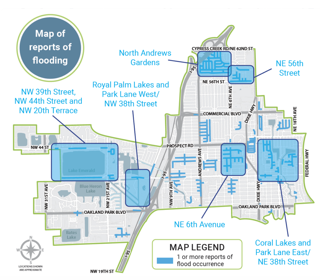
Areas At Risk
This map is from the King Tide informational mailer sent out by the City. It shows areas where flooding has been reported more than once. Oakland Park residents can also check the flood zone in the their area by using the FEMA Flood Zone tool. After an address is entered, FEMA will display the flood zones in the area.
Keeping Dry, Staying Safe and Protecting Property
The geography of where we live coupled with the climate make keeping dry and staying safe a joint effort. The City of Oakland Park for its part has worked on and is working on updating its infrastructure to handle the storm water. Nevertheless the infrastructure because of the geography has its limits. Until these shortcomings can be overcome our best bet for keeping dry, staying safe and protecting property is a joint effort between city and citizen.